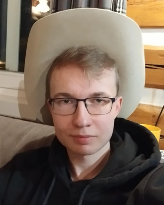
Štěpán Čech
GIS specialist, data analyst and map application developer
- GIS
- Python
- Process automation
- Web applications
- Data mining
Currently looking for a student internship and remote work.
I study geoinformatics and cartography at Palacký University Olomouc. I focus on GIS, spatial data, automation and web map application development.
For my master’s thesis I am building a map application for beekeepers. It brings together climate data and data from monitoring how bee colonies overwinter, to help beekeepers make decisions and plan interventions in their colonies.
I enjoy using geoinformatics to solve real problems. I am gradually widening my focus beyond GIS itself towards web development, database administration and self-hosted solutions.
Portfolio
Beekeeping Decision Support System Based on Climate Data Analysis
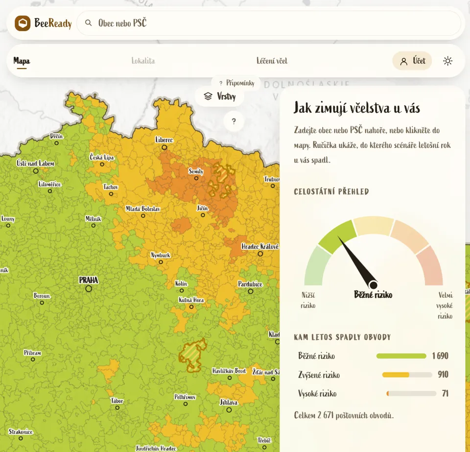
Master's thesis focused on developing BeeReady, a web map application to support beekeeping.
- Helps beekeepers make decisions and plan interventions during the season
- The results for each location are refined every week as the climate develops
- Combines climate data with data on overwintering honey bee colonies in Czechia
- Developed and run on self-hosted infrastructure
- Python
- Django
- PostgreSQL
- PostGIS
- OpenLayers
- Historical Weather API
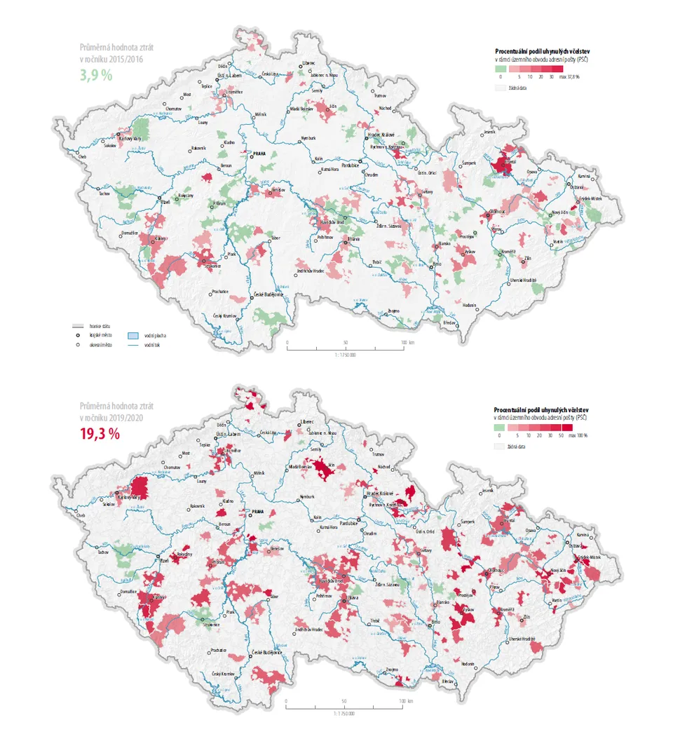
Evaluation of the impact of climate change on the success of overwintering honey bee colonies in Czechia
Bachelor's thesis analysing how the changing climate affects the overwintering success of bee colonies.
- Helps identify the climate variables that most affect overwintering
- Statistically evaluates the link between climate anomalies and colony losses
- Combines climate data with data on overwintering honey bee colonies in Czechia
- The BeeReady application builds on its results
- Python
- GIS
- ModelBuilder
- Data mining
- Statistical analysis
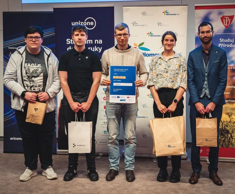
AMOV: road wear assessment from sensor data
Team project focused on continuously assessing the rate of road wear.
- Evaluates road wear and proposes suitable reconstruction periods and diversion routes
- Uses data from the sensor network of the city of Olomouc
- Python
- Sensor data
- GIS
- Time series analysis
- API
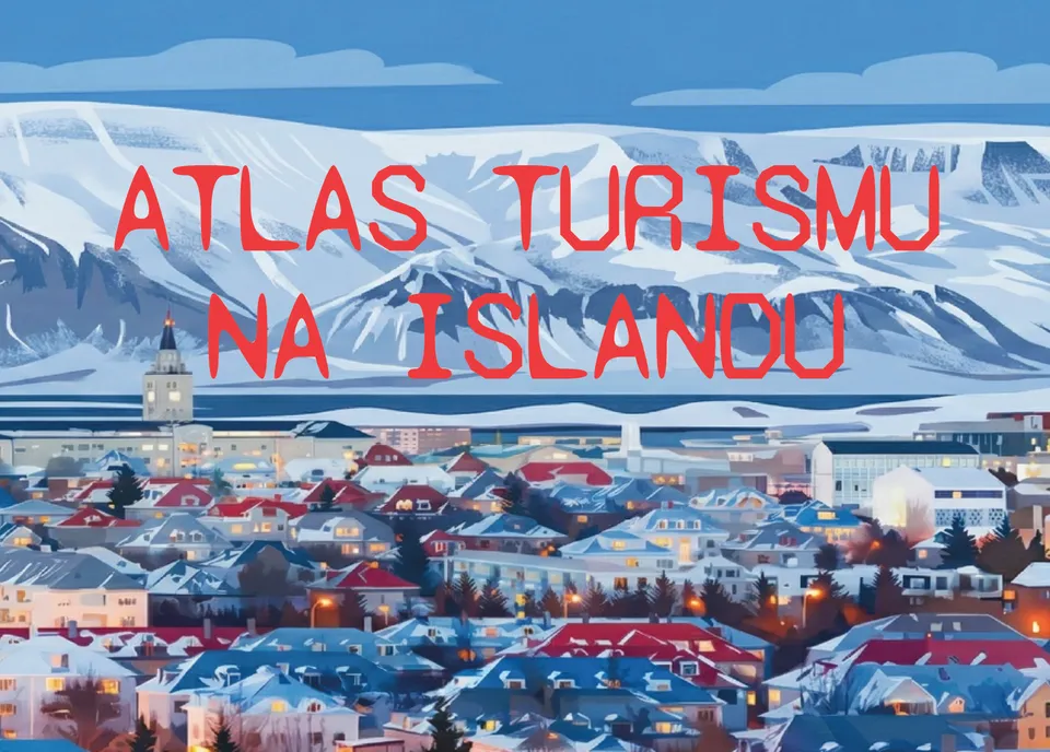
Atlas of Tourism in Iceland
Semester project focused on designing and producing an atlas chapter.
- Shows the current state, structure and particulars of tourism in the “land of fire and ice”
- Shows the tourism potential in terms of accommodation, attractions and transport
- Cartography
- Atlas design
- GIS
- Python
- Adobe Illustrator
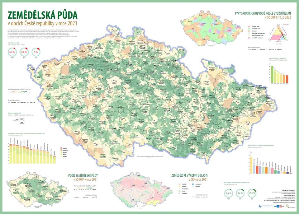
Agricultural Land in Czech Municipalities
Semester project focused on producing an A0 wall map.
- Gives a complete picture of the spatial distribution and state of agricultural land
- Brings individual maps and charts together into a clear map composition
- Cartography
- GIS
- Analytical maps
- Complex maps
- Adobe Illustrator
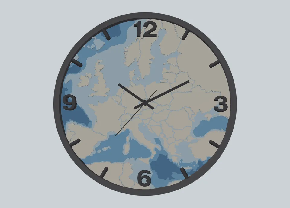
Wall Clock with a Map of Europe
Semester project focused on designing and printing a practical 3D model.
- Shows national borders and the relief of the seabed in depth zones
- Uses GIS to prepare the source data for the 3D model
- 3D modelling
- 3D printing
- GIS
- Blender
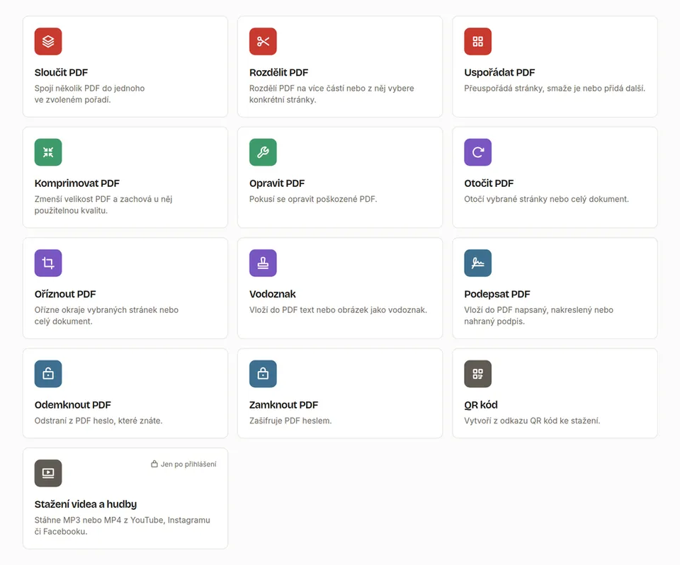
Tools for Editing, Downloading and Generating Documents
A custom set of tools for editing PDFs, generating QR codes, and downloading videos and music.
- A free alternative to commercial online services, with no limits on file size or number of files
- The tools process documents on the user's side, right in their browser
- TypeScript
- WebAssembly
- Node.js
- PDF.js
Work
Data Quality Controller
Regional Authority of the Zlín Region
Zlín, hybrid
- Checking and editing data for the Digital Technical Map of the Zlín Region project
- Developing automated workflows for checking technical and transport infrastructure data
- Identifying and removing duplicate data
Intern
Regional Authority of the Zlín Region
Zlín, hybrid
- Developing automated workflows for downloading RÚIAN data and converting it to DGN
- Preparing and processing spatial data
- Checking the Digital Technical Map of the Zlín Region
Looking for an intern or a new member of your team? I am available, just get in touch.
Education
Geoinformatics and Cartography
Faculty of Science, Palacký University OlomoucMaster's degree
Web GIS and map servers · Software engineering · Data mining · Geostatistics · Database systems · Systematic cartography
Geoinformatics and Cartography
Faculty of Science, Palacký University OlomoucBachelor's degree
GIS · Remote sensing · Statistics · Spatial planning · Thematic cartography · 3D printing · Programming · Eye tracking
Plumbing and electrical installation technician
SPŠ OtrokoviceSecondary technical school, Maturita (school-leaving exam)
Electronics · Electrical technology · Heating and ventilation · Gas engineering · Technical documentation
Vocational certificate as an electrician, obtained in the third year
Study abroad
University of Aruba
Oranjestad, Aruba
Erasmus+
Studying sustainable engineering: the Sustainable Development Goals (SDGs), strategic management, statistics and informatics
Pavol Jozef Šafárik University in Košice
Košice, Slovakia
International Remote Sensing Summer School
Summer school in remote sensing: hyperspectral imaging, LiDAR, photogrammetry and drone mapping
Skills
GIS and spatial data
ArcGIS Pro · QGIS · ArcGIS Enterprise · PostGIS · GeoPandas · Shapely · Rasterio · GeoAI
Programming and development
Python · PyTorch · RStudio · JavaScript · OpenLayers · Django · PostgreSQL · APIs · Git
Infrastructure and AI-assisted development
Linux server (Ubuntu) · Cloudflare · Tailscale · Netdata · Umami · Claude Code
Process automation
ModelBuilder · Model Designer · Data Interoperability
Remote sensing and photogrammetry
SNAP · Agisoft Metashape · CloudCompare · DTM/DSM
Languages and other
Czech (native) · English (professional working proficiency) · Japanese (elementary) · Driving licence (category B)
Didn't find the skill you're looking for? No problem, I'll learn it.
About me
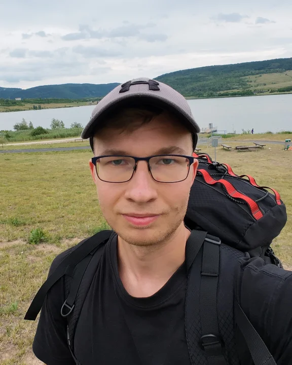
- I’ve been a beekeeper for more than ten years and look after four colonies
- I do sport practically every day: calisthenics, judo, running, cycling and swimming, and other sports now and then
- I like pushing my own limits, in sport and beyond
- I love travelling and discovering new places, whether on foot, by bike or by plane
- I’m interested in Japanese culture, which is why I’m learning Japanese
- In both my personal and working life I like trying out new things and technologies
I don't stop when I'm tired. I stop when I'm done.Contact
Interested in working together? Write to me.